|
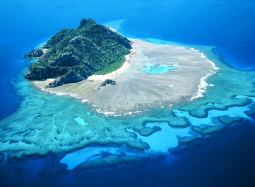
Geography of Fiji. Fiji is a bunch of volcanic islands in the South Pacific, lying about 4,450 km (2,775 mi) southwest of Honolulu and 1,770 km (1,100 mi) north of New Zealand. The two largest islands are Viti Levu and Vanua Levu, and between the two of them make up 87% of Fiji's total landmass. These mountainous islands appeared around 150 million years ago through volcanic activity, and were later covered in thick tropical forests. Most of Fiji's mountains are dormant or extinct volcanoes. Mount Tomanivi, located on the main island of Viti Levu, is the highest point at 4,341 feet (1,324 m), and the lowest point is the pacific ocean (0 m). Main facts Capital - Suva Official languages - Most spoken languages in Fiji are English, Fijian & Hindi. Population - The population is around 858,038. Religions- Fiji is a multi-cultural country, There are many major religious such as Christian,Sikh & Hindu. There are also temples around provided for these religions. Climate - The climate in Fiji is mostly warm & tropical, Including the smaller islands in winter months. The average temperature in Fiji is 25°C (77°F), But it can increase to 30°C (86°F) in summer, (December & January ) And drop to 18°C (64°F) in winter (July and August). Many people consider winter from May - October, Which is the best time for a holiday. The ocean around Fiji usually has a a good temperature around 27°C (81°F), so ocean activities, such as swimming, snorkeling and diving can be enjoyed all year-round. Flag The flag of Fiji has a light blue field with the flag of the UK in the upper hoist-side, and the Fijian shield centered on the outer half of the flag. Fijian shield taken from Fiji's coat of arms shows a yellow lion holding a cocoa pod between its paws above a white field quartered by the cross of Saint George; the four quarters depict stalks of sugarcane, a coconut palm tree, bananas, and a white dove. |


|
